BOOK A DRONE PILOT !

Bird Dog Drone Services is an FAA-Licensed Commercial Drone Pilot and an official partner with Drone Deer Recovery, making us one of the most trusted providers of thermal drone recovery services in Florida and South Georgia. We proudly serve communities across the state—from Jacksonville and Tallahassee to Orlando, Tampa, Daytona, Miami, and everywhere in between—helping families and hunters recover what matters most.
Using advanced thermal drone technology, our team specializes in locating lost pets, tracking wounded game, assisting in missing person searches, and more. With professional-grade equipment and a growing network of skilled pilots, we deliver fast, safe, and reliable results when every second counts.
If you’re searching for a “thermal drone near me” or need professional drone recovery anywhere in Florida or South Georgia, Bird Dog Drone Services is your trusted choice for dependable recovery and aerial support.
For All of Our Services Contact Us at 904-860-0968
Our Services include but are not limited to Land Management, Search & Recovery, and Property and Infrastructure Assessments
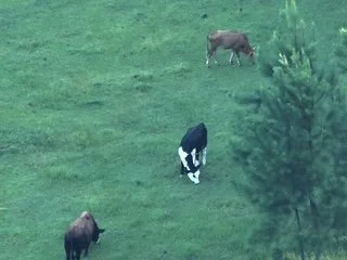
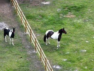
Herd & Predator Analysis – Drone Services for Florida & South Georgia
Pricing: Call for a Custom Quote
At Bird Dog Drone Services, we use thermal drones to monitor herds and detect predators across Florida and South Georgia. Our aerial technology provides real-time insights into livestock health, movement, and location, while also identifying potential predator threats before they become costly losses. Unlike traditional ground checks, drones reduce stress on animals, save time, and give ranchers accurate data from above.
Orthomosaic Mapping for Agriculture & Land Management
Our drones produce high-resolution, georeferenced orthomosaic maps, giving landowners precise data for land planning, crop management, and property assessment. This technology makes it easy to survey large areas quickly and cost-effectively, with more detail and accuracy than outdated methods.
Benefits of Using a Drone for Land Management
Drones provide a safer, faster, and more affordable way to monitor herds, protect property, and analyze land. By delivering accurate, real-time aerial data, we help farmers, ranchers, and land managers make smarter decisions while avoiding the risks and expenses of heavy equipment or manual inspections.
For All of Our Services Contact Us at 904-860-0968
Property & Infrastructure Assessments
Pricing Call for Custom Quote
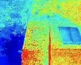
Solar Farm Assessments
Drones equipped with thermal imaging can quickly detect faulty panels, wiring issues, or energy losses across large solar farms. This ensures maximum efficiency while reducing costly downtime.
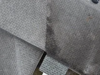
Roof Assessments
Aerial drones safely capture detailed imagery of rooftops to spot leaks, damage, or wear without the need for risky manual climbs. This allows property owners to plan repairs quickly and cost-effectively.
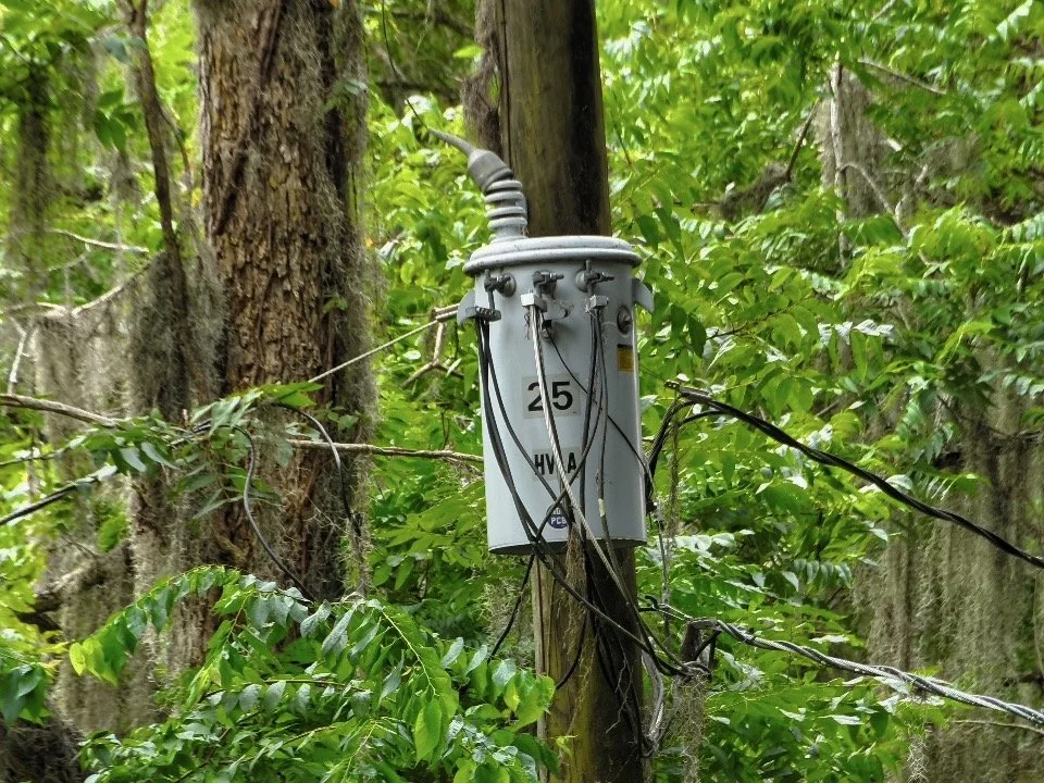
Power Pole Assessments
With high-resolution cameras, drones can inspect power poles and lines for wear, corrosion, or hazards without interrupting service. This helps utilities catch problems early and extend infrastructure life.
Benefits of Using Drones
Drones provide safer, faster, and more affordable inspections compared to traditional methods like bucket trucks or scaffolding. They minimize risk to workers, reduce downtime, and deliver precise data for proactive maintenance.
Search & Rescue Drone Services Florida & South Georgia
Pricing starts at $300 for local searches, with additional fees for extended travel. Recovery Fee once the animal is found: $100.
Lost Pets, Livestock & Missing Persons
When a pet, farm animal, or loved one goes missing in Florida or South Georgia, every minute counts. Our enterprise-grade thermal drones use advanced infrared imaging and high-resolution cameras to scan large areas quickly, detecting heat signatures in woods, fields, tall grass, or at night. Drones reach places that are too dangerous, difficult, or time-consuming for ground search teams, making recovery faster, safer, and more effective.
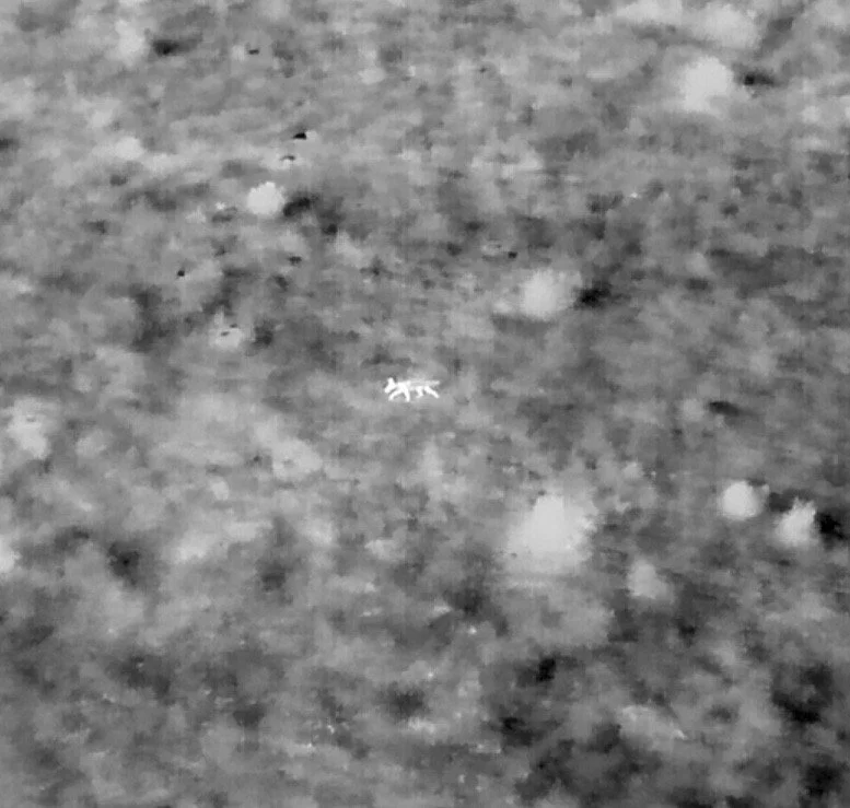
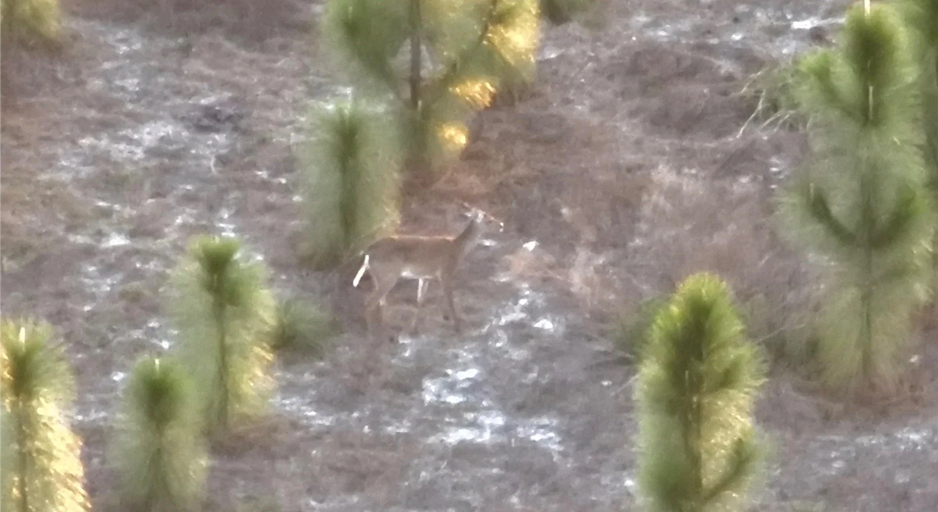
Drone Game Recovery
After a hunt, recovering downed game can be tough—especially in dense forests or low-light conditions. Our thermal-equipped drones cover fields and timberland in minutes, accurately locating animals and ensuring an ethical recovery. This reduces wasted time, prevents loss of valuable harvest, and gives hunters peace of mind.
Why Choose Drone Search & Rescue?
Traditional search methods are slow, limited, and often miss hidden targets. With thermal drones, we can scan acres in minutes, fly over tough terrain, and detect heat that the human eye can’t see. This means faster results, more recoveries, and safer searches for pets, livestock, missing persons, and game recovery throughout Florida and South Georgia.
Bird Dog Drone Services – FAQ
Frequently Asked Questions (FAQ)
At Bird Dog Drone Services, we specialize in thermal drone pet recovery, herd monitoring, and predator detection across Florida and South Georgia. Our FAA-licensed and insured pilots use advanced thermal imaging technology to locate lost pets quickly, monitor livestock health, track herds, and spot predators before they become a threat. Whether you’re a pet owner needing urgent recovery or a rancher looking to protect and manage your herd, our drone services provide fast, accurate, and reliable results.
1. What areas do you provide drone services in?
Bird Dog Drone Services proudly serves all of Florida and South Georgia, offering thermal drone inspections, lost pet recovery, herd monitoring, aerial mapping, and more. We are based in North Florida but travel to Orlando, Tampa, Jacksonville, Daytona, Lake City, and beyond.
2. How much does lost pet recovery with a drone cost?
Our lost pet recovery drone services start at $300 for the first two hours, with a $100 recovery fee if your pet is found. Additional fees may apply for travel outside our local service area.
3. How do drones help find lost pets or missing persons?
Our thermal drones detect heat signatures, even at night or in thick brush. This allows us to locate lost pets, livestock, or missing persons faster and safer than traditional ground searches.
4. Do you provide game recovery services for hunters?
Yes! We offer thermal drone game recovery in Florida and South Georgia. Using thermal imaging, we can quickly locate downed deer or other game, saving time and ensuring an ethical recovery.
5. How can drones help farmers and ranchers?
Our drones provide herd and predator analysis, allowing ranchers to monitor livestock health, count herds, and detect predator activity. This reduces stress on animals while giving farmers accurate, real-time insights.
6. What is orthomosaic mapping and why would I need it?
Orthomosaic mapping creates high-resolution, georeferenced aerial maps of farmland, property, or construction sites. This helps with crop management, land planning, property assessments, and environmental monitoring with far greater accuracy than ground surveys.
7. How can drones improve solar farm, roof, or power pole inspections?
Drones make inspections faster, safer, and more cost-effective by eliminating the need for ladders, lifts, or shutting down equipment. Our thermal imaging can detect faulty solar panels, roof damage, or electrical issues before they become major problems.
8. Do you offer aerial photography and videography?
Yes! Bird Dog Drone Services provides professional aerial photography and video for real estate, events, and promotional content. We can also create social media-ready photos and reels to help showcase your property or brand.
9. Are your drone pilots licensed and insured?
Absolutely. All of our pilots are FAA Part 107 licensed and fully insured, ensuring that your project is handled safely, legally, and professionally.
10. How do I book a drone service with Bird Dog Drone Services?
You can call us directly at 904-860-0968. We recommend booking as soon as possible, especially for urgent searches or time-sensitive inspections.